 USD $
USD $ EUR €
EUR € HKD HK$


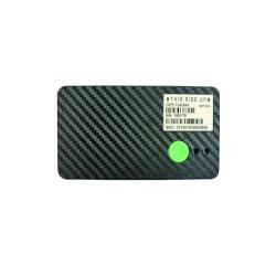
Hot GPS Tracker

Home > Blog
Ship positioning system application
Ships are used as vehicles for transportation or operations in waters. Such as civil ships, warships, boats or boats, etc., covering a wide range. Especially when the ship encounters special circumstances during the journey, such as natural disasters or damage to the hull, when the ship sinks, and the equipment on the ship is damaged, it is impossible to seek help from the monitoring department in time, which may cause heavy casualties or property losses. If the rescue part cannot read the ship's position data in time, accurately locate the ship's position. Therefore, if the relevant management department is unable to monitor and manage the ship without interruption, it will affect the monitoring and management capabilities and the ship's navigation safety.

In order to ensure the safety of ships’ navigation, a ship locator has appeared on the market to solve the problem that ships cannot call the police in time when they are in distress, and can provide accurate location information to the monitoring department, which will lead to reduced ship monitoring and management capabilities and ship safety. , To ensure the safety of navigation.
Ship positioning has two meanings: one is to use navigation instruments to determine the coordinates of the ship on the surface of the earth, or to determine the precise position of the ship independently without referring to any original position reference; the other is to keep the ship or floating platform at a set position Or a positioning method in azimuth. Since the 1950s, with the development of technology, dynamic positioning technology has emerged. Dynamic positioning is a positioning method in which the ship or floating platform uses its own power to resist the influence of sea wind, waves and currents through an automatic control system, and automatically maintains and maintains a set position or orientation.
From the perspective of technical means, the selected ship positioning system has the following three mainstream positioning methods:
1. Positioning ships on coastal CDMA networks
That is, the dynamic monitoring of coastal ships is realized through China Telecom's CDMA network (formerly China Unicom). This positioning method requires ship-based transmitters and shore-based receivers to implement ship dynamic data transmission through the CDMA network. The prominent disadvantage of this positioning method is that it can only be used in coastal areas with CDMA signals, and is more suitable for coastal transportation ships.
2. Satellite positioning ships
Refers to the transmission of ship position data to the company through the on-board satellite launch and reception device. This method is not restricted by the sea area where the ship is located, and can better realize all-weather monitoring. But the outstanding disadvantage is that satellite communication is expensive and not suitable for continuous monitoring.
3. AIS positioning ships
Refers to real-time mastering of ship dynamic data through the signal sent by the ship's AIS system. The full name of AIS is Automatic Ship Identification System, and it is mandatory to install the AIS system on any ship with more than 500 gross tonnage in the world, so it covers a very wide range of ships. Since the signal emitted by the shore-based AIS system can only cover the surrounding distance of 30 nautical miles, the AIS system can only realize the dynamic monitoring of ships in the port area. The satellite AIS system is one or more low-orbit satellites (satellite orbit altitude is between 600 km and 1000 km), and AIS transceivers are mounted on these satellites to receive and decode AIS messages and forward the information to the corresponding earth station. , So that the land management agency can grasp the relevant dynamic information of the ship. Satellite AIS applications are relatively few, only BLM-Shipping uses low-orbit satellites to provide ship AIS positioning and tracking services.
The realization of ship positioning application has very important commercial value. On the one hand, shipping companies, charterers and other ship operators can remotely monitor the real-time dynamics of the ship, so that they can understand the safety management of the ship and the execution of the schedule. On the other hand, for the port management agency, it can realize all the monitoring of ships in the port area, which facilitates better arrangement of operation plans and guarantees the safety of the port area. In addition, ship service auxiliary industries such as ship agency companies and spare parts material supply companies can contact shipowners in advance to obtain more business opportunities by realizing the mastery of ship dynamics in their ports.
The GPS positioning system provided by Shenzhen Yilian Company can add greater protection to the safety of ships. If necessary, please contact us.
Tags: ship locator, ship positioning system, ship positioning application
Related content reading
The difference between a long standby GPS tracker and a GPS tracker
Free installation of three-year long standby GPS locator
- Contact EELINK
 Globalsales@eelink.com.cn
 tan3051_1
 +86 18218746415
- NEWSLETTER
- Getting the latest GPS devices news From Eelink.
- SUBSCRIBE
CopyRight 2025 Eelink Communication Technology Limited All Right Reserved